
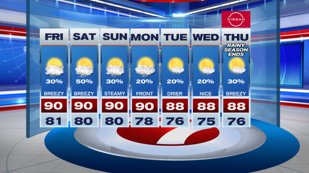
South Florida is in for a warm and breezy Friday with a mix of sun and clouds. Southeast winds will pick up throughout the day, with a few afternoon showers and storms developing mainly across the interior and Southwest Florida. Highs will reach around 90 degrees.
Saturday looks wetter as more tropical moisture moves into the region. Scattered showers and storms are expected, especially near and north of Alligator Alley.
Conditions should gradually improve Sunday as winds relax and rain chances decrease. Looking ahead, a weakening front could bring drier air and noticeably lower humidity by Tuesday and Wednesday.
Coastal concerns continue with King Tides potentially causing minor flooding around high tide. Rip current risks are also increasing along Atlantic beaches, while rougher Gulf waters will make boating hazardous.
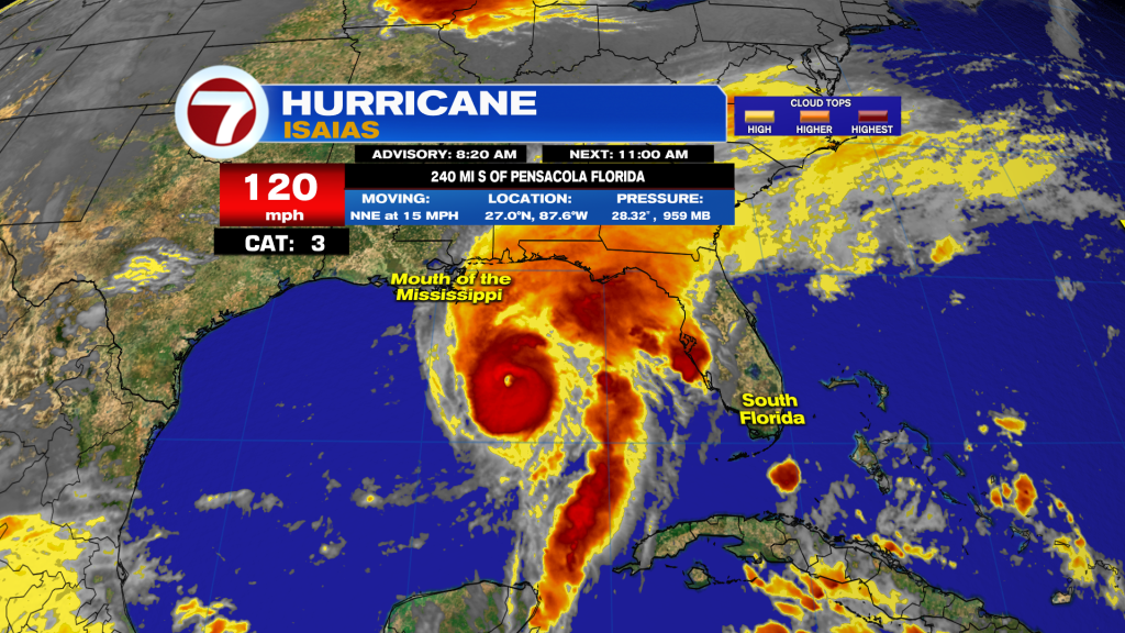
Hurricane Isaias strengthened into a Category 3 hurricane with 120mph winds Friday morning. The storm is moving north-northeast toward the Alabama and western Florida Panhandle coastline, with landfall expected tonight into early Saturday.
Life-threatening storm surge of 6 to 9 feet is possible along portions of the Florida Panhandle. Heavy rainfall of 4 to 8 inches, with isolated totals up to 15 inches, could lead to significant flooding. Damaging winds and isolated tornadoes are also concerns.
Have a wonderful weekend South Florida and make it a safe one!
Vivian Gonzalez
Meteorologist, AMS Certified
WSVN Channel 7


